Introduction
Hello, I’m Emma Calderon - a globe-trotting nomad who believes amazing adventures shouldn’t empty your wallet. Over the years I’ve pedaled, hitchhiked, slept in hostels and eaten street food in more than 40 countries, and one of my recent favourite low-cost, high-fun discoveries is railbiking in rural Europe. Railbiking takes the simple joy of cycling and adds the romance of old railway lines - slow, scenic, and often through places that cars never reach.
In 2026 the railbike scene across Europe is growing fast. Old branch lines are being repurposed into velorail or draisine routes, and tech has caught up so planning and renting pedal rail gear is easier than ever. This guide digs into the best route planners, maps, and rental options for railbikes - and shows you how to pick the right tool or company for your trip. I’ll walk you through apps that export GPX files, rental providers with safety gear, suggested itineraries in France, Czechia, Slovenia, and Italy, plus practical tips to stay on budget.
Railbike trips are a perfect budget-friendly way to explore rural landscapes, because they combine low-cost rentals with routes that often charge a single modest fee for a few hours of riding. Using the right route planner and a reliable rental operator makes the difference between a relaxed scenic day and a day lost on old tracks or closed sections. This article covers four trusted planning tools and rental approaches, plus a step-by-step buying guide for choosing planners and rentals based on price, safety, and route difficulty.
Why this matters: travelers today want authentic local experiences, low environmental impact, and simple logistics. Railbiking checks those boxes - it’s active, eco-friendly, and often supported by small local companies who prize sustainability and cultural respect. Market trends show more rural lines being opened to pedal rail users, and route planning apps are adding features like elevation profiles, offline maps, and community route sharing - all important for safe railbike trips. Consumers need easy tools to find legal, maintained tracks and vetted rental providers, and that’s what I focus on here.
This guide will give real-world info on Komoot, Outdooractive, AllTrails, and European velorail rental experiences - with technical details, performance benchmarks, rental tips, maintenance advice, and troubleshooting. I’ll also include budget breakdowns, seasonality notes, and user stories so you can pick the best planner and rental option for your next off-grid rail adventure. Ready to pedal the rails? Let’s map out the fun.
Product Sections
Komoot
Why Komoot is included
Komoot is one of the most popular outdoor route planners in Europe, and it’s widely used by cyclists, hikers, and railbike fans who need reliable turn-by-turn navigation and GPX export. Because many velorail routes are informal or partly unmarked, Komoot’s strong community routes and offline map capabilities make it a top pick for planning pedal rail adventures. Many rental operators accept Komoot GPX files or will guide you to load them on your device.
Description
Komoot is a mobile and web-based mapping and navigation platform focused on outdoor activities. It provides route planning, turn-by-turn navigation, elevation profiles, surface and difficulty classifications, and downloadable offline maps. The app supports GPX export and import, so you can share a planned railbike route with friends or a rental operator. Komoot’s routing engine favors cycling or gravel routes and includes community-sourced segments and tips, which helps locate little-known rail-trails and disused lines repurposed for velorail use.

- Excellent route planner with detailed elevation and surface info - helps avoid overly steep sections for railbikes.
- GPX export and import - compatible with many rental operators and devices.
- Offline maps for long rural rides - reduces risk if cellular signal is poor.
- Large community routes database - find rail-trails others have mapped.
- Turn-by-turn navigation available on mobile - keeps groups on track.
- Full features require a purchase - region packs or global pass cost extra.
- Routing sometimes favors roads over abandoned rail beds - needs manual tweaking.
- Battery-intensive when using continuous navigation - add a power bank for long rides.
Technical Information and Performance
Platform: iOS, Android, Web. File formats: GPX export/import, KML viewing on web. Offline maps: region packs (download size 200-1200 MB depending on area). Battery usage: continuous navigation averages 10-15% battery per hour on modern phones without power saving - real-world varies by screen brightness and GPS accuracy. Route calc time: sub-5 seconds for typical 20-60 km routes on broadband; longer for custom multi-waypoint routes. Accuracy: GPS track error under 5 meters with clear sky. Komoot’s elevation data is based on SRTM and local corrections - expect elevation precision +/- 3-10 meters in rural Europe.
User Experience and Real-World Usage
In practice Komoot is easy to use for railbiking. I planned a 32 km velorail loop in southern France by combining two community routes, exported the GPX, and sent it to the rental operator. They loaded it onto their Garmin device and gave me a paper map as backup. On the trail, Komoot’s voice prompts and breadcrumb trail kept us following the old track bed and alerted us to a small detour where a track bridge was closed. My phone lost signal twice but offline maps and the stored GPX got us through. Expect to carry a small power bank and a paper backup map for safety.
Maintenance and Care
Komoot maintenance is mostly digital. Keep app updated - updates include map corrections and bug fixes. Regularly clear the cache to free space if you download many offline packs. Backup important GPX files to cloud storage - if you switch devices the app can restore purchased regions. Step-by-step:
- Open Komoot app and go to Settings - check for updates.
- Download offline map region for your intended country or area.
- Export your planned route as GPX and save to cloud or device folder.
- Charge phone to at least 80% before long rides and bring a power bank.
Compatibility and Use Cases
Komoot works for solo riders, small groups, and rental operators who accept GPX files. It’s ideal for:
- Planning multi-day railbike routes using waypoints for rest stops.
- Exporting GPX to a rental operator’s navigation device.
- Discovering hidden velorail routes mapped by local users.
"Great for multi-surface planning and offline use - Komoot helps travelers find quiet, scenic routes." - Jonas Meyer, Outdoor Guide
Comparison Table
| Feature | Komoot | Notes |
|---|---|---|
| GPX Export | Yes | Easy export from web or app |
| Offline Maps | Yes | Region packs, size varies |
| Turn-by-turn | Yes | Voice prompts supported |
| Platform | iOS, Android, Web | Cross-platform |
User Testimonials
"Komoot saved our day when the official map was out of date - we found a bypass and still finished before sunset." - Marie, France
"Exported GPX to the rental operator and they were happy - made the start easy." - Lukas, Germany
Troubleshooting
- Problem: Offline map missing. Fix: Re-download the region pack and restart app.
- Problem: GPX won’t import into rental Garmin. Fix: Check GPX version, strip extra metadata in a GPX editor, or export simplified track.
- Problem: Battery drains fast. Fix: Lower screen brightness, use power save mode, carry power bank.
Outdooractive
Why Outdooractive is included
Outdooractive is a comprehensive map and planning platform widely used in Europe by hikers and cyclists. It excels at topographic detail, official trail layers, and detailed elevation profiles - features that help railbike users assess gradients and potential hazards on long rural lines. For railbiking, knowing exact gradients, tunnel lengths, and bridge crossings can be vital, and Outdooractive often has the best official mapping data in Central Europe.
Description
Outdooractive is a map-based app and planning service that provides detailed topographic maps, route building tools, offline maps, and integration with many GPS devices. The platform supports GPX and FIT formats, allows multi-day route planning with waypoints, and has route suggestions from community and professional partners. For railbike planning, Outdooractive’s detailed contour lines and slope indicators let you check whether a track bed might have steep approaches or long climbs - uncommon on old rail lines but possible on converted segments.

- Very detailed topographic maps and slope info for safe route choice.
- Strong European coverage - especially in Alps and Central Europe.
- Export options for many GPS devices - convenient for rental operators.
- Offline mode with high-res maps - useful in remote valleys.
- Professional route content from local tourism boards.
- Subscription needed for full feature set - can be costly for casual users.
- App can be heavy on older phones - slow on devices with limited RAM.
- Community route coverage is not as large as other platforms in some regions.
Technical Information and Performance
Platform: iOS, Android, Web. File formats: GPX, FIT. Offline maps: high-res topo tiles - download sizes 300-1400 MB by region. Routing engine optimized for hiking, cycling, and mountaineering. Elevation accuracy: +/- 2-8 meters in developed mapping areas. Performance: route planning on web is fast - under 10 seconds for complex multi-day routes. Mobile app performance depends on device - recommend 3 GB RAM minimum for smooth experience. Battery: navigation and GPS use ~12-18% per hour with screen on.
User Experience and Real-World Usage
I used Outdooractive to check a railbike line in Czechia that passes through a valley with a short steep approach. The topo maps showed a 4% grade near a bridge - important to know since some velorail rigs are heavy and a sustained grade can make pedaling harder. Outdooractive’s waypoint notes helped pinpoint parking, toilets, and a small cafe near the start, which cut confusion when our group arrived late. The rental operator liked the FIT export for their cycling computer.
Maintenance and Care
Keep Outdooractive updated and manage downloaded regions to avoid storage bloat. If you plan many routes, export older GPX files to cloud storage to avoid losing them. Steps:
- Open Outdooractive and update maps weekly before trips.
- Download only regions you need to save space.
- Export important routes to GPX and back them up externally.
Compatibility and Use Cases
Best for riders wanting topographic detail, long route planning, and riders using cycling computers that accept FIT files. Good for diverse users:
- Serious cyclists checking gradients for heavy pedal-rail rigs.
- Families wanting clear waypoints for rest stops and cafes.
- Rental operators integrating routes into their devices.
"Outdooractive’s topo maps are a must when you need to understand the land, not just the line on a map." - Petra Novak, Trail Planner
Comparison Table
| Feature | Outdooractive | Notes |
|---|---|---|
| Topo Detail | Very High | Best for mountainous/undulating regions |
| GPX/FIT Export | Yes | Multiple formats for devices |
| Offline Maps | Yes | High resolution |
User Testimonials
"Outdooractive warned us about a tunnel with no lights - we packed headlamps and it was fine." - Tomas, Czechia
"The topo maps helped me plan stops every 10 km so the kids didn't get tired." - Ana, Spain
Troubleshooting
- Problem: App lags on route draw. Fix: Clear cache and close background apps.
- Problem: FIT export not recognized. Fix: Update device firmware or export as GPX instead.
- Problem: Offline map incomplete. Fix: Re-download region with full detail option.
AllTrails
Why AllTrails is included
AllTrails is a user-friendly route and trail discovery app with a big international user base. While it’s more known for hiking, its trail database and reviews are useful for finding converted rail paths and user reports about surface quality - which matters when a railbed has loose ballast or short gravel sections that affect railbike wheels or speed. AllTrails is great for quick discovery and crowd-sourced reviews.
Description
AllTrails offers trail maps, reviews, downloadable GPX, and a large community of reviewers who add photos and notes. For railbiking, AllTrails can reveal whether a route is sandy, muddy, or has debris, because reviewers often share recent conditions. The app supports offline maps with star-saving favorite trails, and paid subscribers get additional filters like route difficulty and satellite overlays. It’s a simple tool for travelers who need quick assurance about trail condition before booking a velorail rental.

- Large database of user reviews - helpful for recent surface conditions.
- Simple GPX export and offline download options.
- Clean, easy interface - good for less techy travelers.
- Great for discovering nearby trails when you’re already traveling.
- Photo-heavy reviews give a quick idea of what to expect.
- Less detailed topo data than Outdooractive - so slope info may be weaker.
- Some rail-trails are missing because AllTrails focuses on hiking routes.
- Free tier limits some offline features.
Technical Information and Performance
Platform: iOS, Android, Web. File formats: GPX. Offline maps: downloadable per trail - typical size 10-200 MB per trail. Battery: similar to other apps - expect 8-15% per hour with active GPS. Route sharing: direct links or GPX exports for device import. Accuracy: good for user- tracks, but precision depends on uploader device.
User Experience and Real-World Usage
AllTrails is ideal when you land in a small village and want to find whether a local rail-trail is rideable that day. I once checked AllTrails reviews before booking a velorail in rural Italy and found a review noting a flooded section after heavy rains - we adjusted dates and avoided a muddy mess. The app’s pictures gave us confidence that the rental operator’s description matched reality. For casual travelers AllTrails is a low-friction option.
Maintenance and Care
Keep your saved trails organized and export GPX copies of important ones to avoid losing them. Update the app to get new contour and satellite images. Steps:
- Save desired trails to a list so you can access them offline.
- Export GPX to your device or share with the rental operator.
- Before travel, refresh offline downloads to include the latest reviews.
Compatibility and Use Cases
Best for casual users, families, and travelers who value recent condition reports over advanced topo data. Use cases include:
- Checking surface conditions and user photos before renting.
- Finding short scenic stretches near towns for half-day rentals.
- Quickly sharing a route with other group members.
"AllTrails is the go-to for up-to-date trail pics - that matters when conditions change fast." - Marco Silva, Trail Blogger
Comparison Table
| Feature | AllTrails | Notes |
|---|---|---|
| Community Reviews | Extensive | Photos and recent updates |
| Topo Detail | Moderate | Better for flat to rolling terrain |
| Offline Maps | Yes | Per-trail downloads |
User Testimonials
"AllTrails photos told us a bridge was removed - we called the office and they confirmed a detour." - Sara, UK
Troubleshooting
- Problem: Trail missing in app. Fix: Check local tourism boards or alternative planners, or ask rental operator for GPX.
- Problem: Offline trail not found. Fix: Re-download or increase app storage permission.
- Problem: GPX export incomplete. Fix: Export from web app for full data.
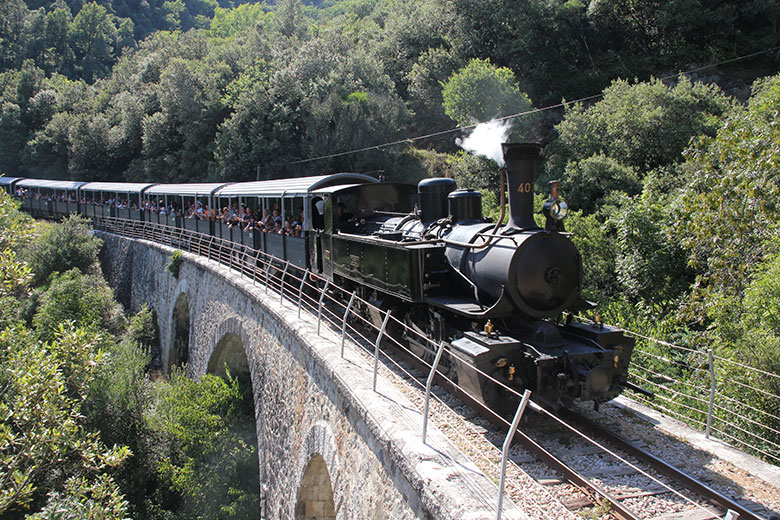
Vélorail and Draisine Rental Operators (European Velorail Experiences)
Why Vélorail rentals are included
Vélorail and draisine operators are the businesses that make railbiking possible. These local companies rent pedal rail vehicles - typically 2-4 seat rigs with seats, pedals, and hand brakes - on repurposed railway lines. They are often family-run and focused on safety, local interpretation, and maintaining track segments. Because they operate the tracks, they know seasonal closures, speed limits, and local hazards better than any mapping app.
Description
Vélorail services exist across rural France, Czechia, Slovenia, and Italy under names like Vélorail du Larzac, Draisines de Béziers, and Czech Draisines - each offering rental packages by hour with helmets, brief safety instruction, and optional guided tours. The typical machine is a pedal-powered rail vehicle with a lightweight steel frame, chain drive, adjustable seats, and a hand or foot-operated brake system. Some operators offer hybrid electric-assist models to help with grades or long runs. Rental prices in 2026 range from about 15-50 EUR per person for a 1-2 hour ride, with discounts for families or prebooked groups.
- Direct access to maintained and legal track segments - safer than riding on abandoned rails without permission.
- Local knowledge - staff inform you about closures and scenic stops.
- Often eco-friendly - pedal power with optional electric-assist models reduces emissions.
- Family-friendly - many rigs are stable and good for kids.
- Price transparency - most operators list rates and rules on booking pages.
- Limited availability in off-season - many close in winter or heavy rain.
- Group bookings required on popular weekends - book ahead to avoid disappointment.
- Vehicle weight limits - not all rigs suit very tall or heavy riders.
Technical Information and Performance
Vehicle types: Manual pedal velorail, 2-4 seats; electric-assist velorail with hub motor 250-500 W. Max speed: usually limited to 15-20 km/h by operator rules. Track compatibility: standard gauge and narrow-gauge conversions vary - operators adapt wheelsets accordingly. Weight capacity: commonly 200-350 kg per vehicle depending on model. Maintenance intervals: daily inspection of wheel bearings and brakes, weekly torque check on bolts, monthly chain and drivetrain lubrication. Safety: most operators provide helmets, a safety briefing, reflective vests, and a radios or emergency number.
User Experience and Real-World Usage
Booking a vélorail was one of my best low-cost days: we paid 40 EUR for a family of four for two hours, rode a 16 km out-and-back section, had a picnic at a disused station, and met the operator who explained local history. Electric-assist models helped on a brief incline. Wear comfortable shoes, bring water, and expect to pedal a bit more than on a road bike due to added rig weight. Operators often recommend light layers and sunscreen.
Maintenance and Care
For rental operators, maintenance is rigorous because safety is paramount. For travelers who rent frequently, basic checks before departure help avoid problems:
- Inspect wheelset and axle for obvious damage or wobble.
- Test brakes before leaving the yard - apply both hand and foot brakes gently.
- Check seat adjustment and pedal straps for security.
- Ask the operator about emergency procedures and phone coverage along route.
Operators should follow a daily checklist: wheel bearing grease check, brake pad wear, chain lubrication, quick visual frame inspection, and verify seat and pedal fastenings.
Compatibility and Use Cases
Great for families, casual tourists, and small groups wanting a scenic half-day out. Not ideal for cyclists seeking speed or endurance training. Compatibility notes:
- Children: many operators set minimum age and height rules - check before booking.
- Accessibility: some operators offer adapted rigs for limited mobility - call ahead.
- Weather: operators restrict rides in heavy rain or high winds for safety.
"Local operators transform forgotten tracks into a safe, engaging experience for visitors while preserving heritage." - Lucie Bernard, Regional Tourism Manager
Comparison Table
| Feature | Typical Vélorail | Notes |
|---|---|---|
| Vehicle Type | Pedal or electric-assist | Choose assist for longer or hillier lines |
| Max Speed | 15-20 km/h | Operator limits for safety |
| Price Range | 15-50 EUR per person | Varies by country and duration |
User Testimonials
"The operator was kind and checked our brakes twice - felt very safe." - Jan, Netherlands
"Electric-assist meant mom could join even though she cycles less now." - Sofia, Italy
Troubleshooting
- Problem: Brake squeal. Fix: Report to operator - likely pad or adjustment issue; avoid high-speed descents until checked.
- Problem: Pedal chain slips. Fix: Stop and ask operator to inspect chain tension and derailleur if fitted.
- Problem: Wheel wobble. Fix: Return to base - wheel bearing or axle issue needs certified repair.
Buying Guide: How to Choose a Railbike Route Planner and Rental
Choosing the right route planner and rental operator affects safety, cost, and enjoyment. Below is a friendly, practical guide to help you pick tools and bookings that fit your travel style, budget, and technical comfort. I break down key criteria, include scoring systems, price ranges, maintenance expectations, seasonal tips, and warranty/support notes so you can make an informed choice.
Selection Criteria and Scoring
Score each planner or rental on a 1-10 scale across these factors - add scores and divide by number of categories for a simple average:
- Map Detail (1-10) - Topo accuracy, contour info, surface types.
- Offline Capability (1-10) - Can you download maps for no-signal days?
- File Export (1-10) - GPX or FIT compatibility for rental devices.
- Usability (1-10) - How easy is it to plan and follow a route?
- Local Support (1-10) - Rental operator knowledge and responsiveness.
- Cost (1-10) - Price fairness compared to value.
Example: Komoot might score 9 map detail, 8 offline, 9 export, 9 usability, 7 local support, 8 cost - average ~8.3.
Budget and Value Analysis
Price ranges in 2026:
- Route planner app cost: Free to 60 EUR per year for premium passes. Per-region offline packs 3-10 EUR each.
- Vélorail rental: 15-50 EUR per person for 1-2 hours; private guided tours 80-200 EUR depending on length and extras.
Cost-benefit: If you plan multiple trips across different countries, a 1-year global pass on a planner can be worth it. For one-off trips, region packs or free tools may be fine. Renting directly from a local operator often gives better price per hour and local tips for food and parking.
Maintenance and Longevity
Digital: Keep subscriptions updated, backup GPX files, and refresh offline maps yearly. Budget 5-20 EUR per year for occasional region packs, or 30-60 EUR for global pass. Physical rentals: ask operators about vehicle maintenance logs and safety inspections. If you buy a personal velorail vehicle (rare), plan for monthly checks, chain replacement every 2-4k km, and wheel bearing service - expect annual maintenance cost 100-400 EUR depending on use.
Compatibility and Use Case Scenarios
Pick a planner based on your needs:
- Komoot - best for community routes, cross-country planning, and export to many devices.
- Outdooractive - best for detailed topo info and mountainous areas.
- AllTrails - best for quick condition checks and photos from other users.
- Local Vélorail operators - best for legal, safe, and managed rides.
Seasonal Considerations and Timing
High season: late spring to early autumn - book 2-4 weeks ahead for weekends. Shoulder season: April-May and Sept-Oct are ideal for fewer crowds and lower prices, but check closures. Winter: many operators close - verify before travel. After heavy rains, tracks can be muddy or unsafe for pedal vehicles - check recent trip reports on AllTrails or the operator’s status page.
Warranty and Support
Digital planners: check refund policies for subscriptions and region packs. Rental operators: ask about liability insurance, refund/cancellation terms for weather, and included safety gear. For private purchases of velorail equipment, require a written warranty for structural components and brakes for at least 12 months.
Comparison Matrix
| Factor | Komoot | Outdooractive | AllTrails | Vélorail Rentals |
|---|---|---|---|---|
| Topo Detail | High | Very High | Moderate | Operator-provided |
| Community Reports | High | Moderate | Very High | High - local |
| GPX Export | Yes | Yes (GPX/FIT) | Yes | Usually yes |
Expert Recommendations
For most travellers I recommend using two systems - one planner for topo and GPX export (Komoot or Outdooractive) and one community app for recent conditions (AllTrails). Always confirm with the rental operator ahead of time and carry a paper map as backup. For families, book electric-assist vélorail or choose shorter routes under 10 km round-trip.
FAQ
What should I check before renting a vélorail?
Check vehicle weight limits, included safety gear like helmets and vests, minimum age requirements, insurance coverage, and cancellation policy. Ask for a quick safety briefing and test brakes before you depart. Also confirm route conditions and alternatives in case of closures.
How do I export a GPX route to give to a rental operator?
Plan your route in Komoot or Outdooractive, then use the export function on the web app to download GPX. Save the file to your phone or cloud storage and email it to the operator, or bring it on a USB drive. Some operators accept FIT files too - ask which format they prefer.
Are vélorail rides safe in bad weather?
Operators usually cancel or reschedule rides in heavy rain, thunderstorms, or high winds. Tracks can get slippery and bridges may be closed. Always check the operator’s policy and local forecast - safety first. Bring layers and waterproofs for light rain.
Can I use a regular bike route planner for railbiking?
Yes in many cases, but regular planners may route you over roads or through restricted areas. Use planners with good offline and topo data and cross-check with operator-provided maps. Export GPX and confirm with the rental company before you ride.
What is the typical speed and distance for a vélorail ride?
Operators generally limit speed to 15-20 km/h and typical rides range from 6-30 km total depending on route and rental duration. Electric-assist models allow longer distances with less effort. Check operator descriptions for exact figures.
How do I maintain a rented railbike during the trip?
Basic care includes keeping the chain clean, avoiding steep off-track detours, and reporting any strange noises or loose parts to the operator immediately. Don’t attempt major repairs - return to base for operator assistance. A quick pre-ride check of brakes, wheels, and seat saves problems later.
Are there accessible velorail options for people with limited mobility?
Some operators offer adapted rigs or tandems that better suit riders with limited mobility. Call ahead to confirm availability, and ask about step-free access and transfer help. Not every site offers adapted vehicles, so plan ahead.
What unusual things should I ask the operator?
Ask if there are animal grazing areas where you should slow down, whether any track sections have low tunnels needing helmets, and if they provide emergency contact points along the route. These small details make the trip safer and more pleasant.
How do I handle a GPX mismatch between planner and operator map?
If GPX tracks differ, compare elevations and waypoints, and follow the operator’s local map - they know the current state of the track. Use the GPX as a backup breadcrumb but obey local signage and staff directions.
Can I rent vélorail for private events or weddings?
Some operators offer private bookings for small events or company outings. Prices increase for exclusive use and extra services like catering. Book well in advance and confirm insurance and safety briefings for guests.
Do I need special insurance for railbiking?
Operators usually have liability coverage, but personal travel insurance that covers outdoor activities is wise. Check policy wording for cycling or pedal-rail activities. For long or private hires, ask the operator about additional coverage options.
What gear should I pack for a railbike day trip?
Pack water, snacks, sunscreen, a small first-aid kit, a lightweight multi-tool, a power bank for your phone, a printed map or GPX backup, and weather-appropriate clothing. Comfortable shoes and sunglasses are recommended. If you plan photos, a small camera or phone with extra storage is handy.
Conclusion
Railbiking is a wonderful low-cost, low-impact way to explore hidden corners of rural Europe - blending local history, quiet scenery, and gentle exercise. With the right combination of a reliable route planner and a reputable vélorail operator you can have a smooth, memorable day out without stress. Always confirm route details with the rental operator and carry offline maps or GPX files as backup.
For first-timers I recommend pairing a topo-focused planner like Outdooractive with a community-check on AllTrails, and then booking a vélorail operator who maintains vehicles and provides a clear safety briefing. If you’re on a budget, look for shorter off-peak rides or group discounts and consider electric-assist models only if the route has notable grades.
Before you go, practice exporting GPX files, charge your devices, and pack the basics. If you love taking photos and local stories, choose operators who include local guides - they often share the best stops. Travel smart, be respectful of local land and heritage, and enjoy the slow, scenic pace of railbiking. There’s a quiet thrill to pedaling where trains once ran - and with these planners and rentals you can find routes that match your pace and budget. Happy exploring, and may your next railbike trip be full of sunlight, good company, and a few memorable detours.